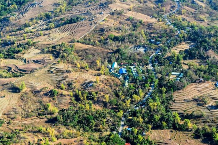
ILOILO City – To determine what interventions were needed, the Office of the Civil Defense (OCD) in Western Visayas conducted an aerial survey of landslide-prone areas in parts of Antique and Iloilo’s 1st District.
The aerial survey on March 21 used as guide the hazard map produced by the Mines and Geosciences Bureau (MGB).
Areas surveyed were the municipalities of Tubungan, Leon and San Joaquin in Iloilo and San Remigio and Hamtic in Antique.
“Gagawa tayo ng program for these areas,” said OCD regional director Jose Roberto Nuñez.
He cited the landslide-prone Barangay Igtuble, Tubungan which he personally inspected just last month. An area in this far-flung barangay had around 155 at-risk families, he revealed.
Nuñez said the OCD had been coordinating with the local government of Tubungan and specifically the latter’s Municipal Disaster Risk Reduction and Management Office (MDRRMO) regarding possible interventions for the families.
During typhoon “Frank” in June 2008 landslide hit Barangay Igtuble. Rescue operations proved difficult.
Nuñez said relocating the families was one of the options being looked into.
“If the local government of Tubungan or the provincial government of Iloilo could provide a relocation area, I could seek help from the national government like the Natinal Housing Authority. I will also write to the President to help in the relocation of the families,” said Nuñez.
With Nuñez during the aerial survey were OCD assistant secretary Casiano Monilla, representatives from MGB and the media.
Prior the aerial survey, OCD Region 6 held the region’s first-ever Disaster Risk Reduction and Management (DRRM) Summit in Antique to raise public awareness on disaster preparedness.
Held at the Binirayan Gymnasium in San Jose town, the summit was participated in by municipal planning officers, barangay officials including Sangguniang Kabataan officers from 590 barangays in Antique./PN


