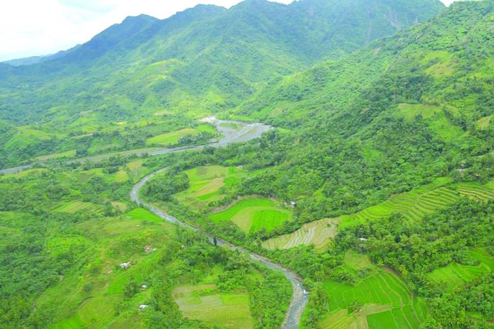
ILOILO City – The earthquakes that shook Panay and Guimaras islands on Monday were “clear and solid” proofs that the West Panay Fault is active, according to a group opposed to the construction of the P11.2-billion Jalaur River Multipurpose Project Stage 2. It pressed for the cancellation of the mega dam project.
According to the Jalaur River for the People’s Movement (JRPM), the fault line was belittled by the National Irrigation Administration (NIA) Region 6 in a 2011 feasibility study on the mega dam submitted to the Korea Export-Import Bank to secure funding for the project.
While the 214-page NIA report acknowledged that the dam’s project area was in contact with the West Panay Fault, it asserted that the fault line was “inactive and have no vestiges in movement,” said JRPM’s John Ian Alenciaga.
This was a clear disregard by NIA of scientific facts to legitimize the mega dam, he lamented.
The West Panay Fault stretches more than 90 kilometers from the Iloilo towns of San Joaquin, Miag-ao, Igbaras, Tubungan, Leon, and Alimodian; Sibalom and San Remigio in Antique; Janiuay and Lambunao in Iloilo; Valderrama, Antique; Tapaz and Jamindan in Capiz; and all the way to Libacao, Madalag and Malinao in Aklan, and Pandan in Antique.
The mega dam would be built in Calinog, Iloilo which is adjacent to Lambunao and Tapaz.
“One irrefutable fact was the January 1948 earthquake. The fault generated one of the strongest quakes in Panay Island and the country at 8.1 magnitude. It toppled 55 Panay churches, including the Jaro Cathedral belfry,” according to JRPM in a statement.
Monday’s quakes with various epicenters and magnitudes shook Panay and Guimaras. Stronger quakes recorded had epicenters in San Jose, Antique (the United States Geological Survey had it in San Remigio, Antique) with magnitude 4.7 and depth of eight kilometers; another one with epicenter in Sibunag, Guimaras had a magnitude of 4.0 and depth of three kilometers; and the strongest at 10:54 a.m. in Guimbal (later revised by the Philippine Institute of Volcanology and Seismology to be in Leon, Iloilo) at 4.8 magnitude with depth of three kilometers.
“With Monday’s series of jolts, we are reiterating our call to stop the construction of the Jalaur mega dam in Calinog that will endanger the lives of millions of Ilonggos,” said Alenciaga.
The mega dam, said to be the biggest outside Luzon, will provide uninterrupted irrigation water to 32,000 hectares of Iloilo farmland, benefit more than 783,000 farmers and increase annual production of rice to 300,000 metric tons from 140,000.
Project contractor Daewoo Engineering and Construction Co., Ltd. have already started building their barracks and motor pool in Calinog.
The project involves the construction of 109-meter Jalaur high dam; a 38.5-meter afterbay dam; a 10-meter Alibunan catch dam; a 80.74-kilometer high line canal; generation of new areas for irrigation; and rehabilitation of existing irrigation system.
Construction activities are expected to generate jobs to around 17,000 workers composed of engineers, carpenters, welders, masons, and drivers of heavy equipment.
The mega dam was initially scheduled for groundbreaking on Oct. 4 but this did not push through. President Rodrigo Duterte was not available on that day due to prior commitments, according to NIA Region 6 public information officer Steve Cordero.
NIA, the project’s implementing agency, wanted the President to lead the groundbreaking.
The signing of the construction contract was already done – on Sept. 3 at the NIA Complex in Quezon City./PN


Structure as dam design to withstand magnitude 9 earthquake without damage. Structure adjacent from fault line has certain standard to follow. Structural Designer are aware of earthquake and it was always considered in the structural design consideration with standard factor of safety according to international standard for Earthquake Engineering.
Structures can be design according to design standàrds at high risk seismic areas. Some cases during high intensity eàrthquàke the foundation or soil failure occurs with secondary effects of high level earthquake àre liquifàction, ground shaking, landslides , ground rupture and fire. With such given scenàrious it should be tested to qualify minimum requirements and in some cases engg intervention follow. A feasibility studies, geotechnical investigation including reports of soil stàbility should be conducted as necessary in detailed engg design. A lot of consideràtion be given classification and consideration prior to proper decission making . 👣rl
DAM Structures can be design according to design standàrds at high risk seismic areas. Some cases during high intensity eàrthquàke the foundation or soil failure occurs due to secondary effects of high level earthquake such as liquefàction, ground shaking, landslides , ground rupture and fire. With such given scenàrious it should be tested to qualify minimum requirements and in some cases engg intervention follow. A feasibility studies, geotechnical investigation including reports of soil stàbility should be conducted as necessary in detailed engg design which màybe done by the principàl designer. A lot of consideràtion be given classification and consideration prior to proper decission making . 👣rl