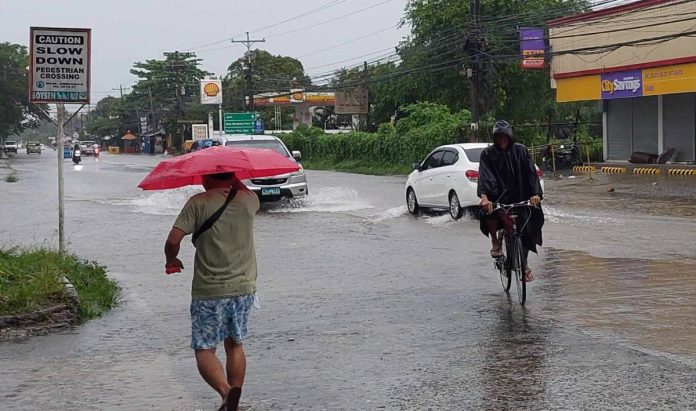
ILOILO – To address flooding, a perennial problem particularly in the central and northern parts of Iloilo, the provincial government is turning to the national government for additional floodways.
According to Gov. Arthur Defensor Jr., for the past three years, the provincial government has identified which areas are flood-prone. But they also noticed new areas being flooded for the first time.
“We want to start the spade work… We need a floodway in central and northern Iloilo, sa gina-agyan sang baha,” Defensor said yesterday afternoon.
There are several river systems across congressional districts, but some do not have the capacity to control the releasing of water to the seas.
Defensor took for example the Jaro floodway in Barangay Buhang, Jaro, Iloilo City that was constructed during the administration of then President Gloria Macapagal-Arroyo.
Started in 2008 and completed in 2011, the P5.5-billion flood control involved the construction of the Jaro Floodway, the improvement of the Tigum and Aganan rivers, as well as improvements of the Jaro River mouth, the Iloilo River and Upper Ingore Creek.
“Kinahanglan ta na subong knowing kon diin na subong ang tubig naga-agi,” the governor said.
Admittedly, such projects could not be attained by the provincial government’s project alone. Thus Defensor sought this to be included as one of the priority projects of the current administration.
“We have to ask from the national government. Indi ina masarangan sang probinsya unless we borrow money. But masarangan sang national government,” he said.
Defensor disclosed that there is an existing data at the Department of Public Works and Highways (DPWH) locating areas in the province where floodways are needed or are feasible as part of the overall water control program of the government.
On the sidelines, this could also mean more sources of potable water, he said.
In the meantime, the provincial government continues to implement its “Limpyo Dalanon” program that aims to declog roads and waterways.
A few months ago, the “Purok Resilience” program was also launched. This is a small-scale barangay level housing project for families previously living in danger zone areas, like along creeks and rivers.
Every year, the Provincial Government Environment and Natural Resources Office also targets to plant 1.5 million trees.
As of 9 p.m. on Tuesday, Aug. 29, data from the Office of the Civil Defense Region 6 showed thet 19 local government units in the province were affected by flooding. These were Dingle, Dueñas, Dumangas, Guimbal, Lambunao, Leon, Miag-ao, Mina, New Lucena, Oton, Passi City, Pavia, Pototan, San Enrique, San Joaquin, San Miguel, Tigbauan, Tubungan, and Zarraga.
A total of 13,423 families composed of 53,668 individuals were displaced although most have returned to their homes as of this writing.
Data further showed that 29 houses were damaged – 23 partially and six totally damaged./PN


