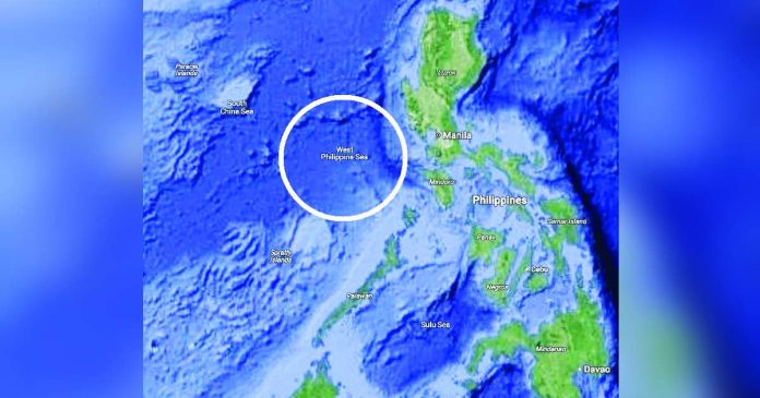
MANILA – The inclusion of the West Philippine Sea (WPS) on Google Maps validates the international recognition of the country’s sovereign rights over the area, the Armed Forces of the Philippines (AFP) said.
According to AFP spokesperson Colonel Francel Margareth Padilla, the Philippine military remains resolute in doing its mandate to protect the country’s territory and uphold national integrity.
“This affirms international recognition of the country’s sovereign rights, as upheld by the 2016 Arbitral Ruling under UNCLOS,” Padilla said in a statement on Tuesday.
“As defenders of national sovereignty, the AFP sees this as a valuable contribution to truthful representation and public awareness,” she added.
A search on Google Maps for Scarborough or Panatag Shoal, a well-known fishing area located within the Philippines’ 200-nautical mile exclusive economic zone (EZZ), indicates that it is situated in the body of water referred to as the West Philippine Sea (WPS).
In 2012, under the leadership of former President Benigno Aquino III, the Philippines officially designated the maritime regions on the western side of the archipelago as the West Philippine Sea.
In 2016, the Permanent Court of Arbitration in The Hague ruled in favor of the Philippines regarding China’s claims in the South China Sea, asserting that such claims had “no legal basis.”
The ruling also confirmed that Ayungin Shoal, the Spratly Islands, Panganiban or Mischief Reef, and Recto or Reed Bank fall within the Philippines’ exclusive economic zone.
Moreover, the Hague court condemned Chinese aggression within the Philippines’ EEZ, affirming that Scarborough Shoal, a valuable fishing resource, serves as a common fishing ground.
Despite this ruling, China has continued to disregard the court’s decision and remains unyielding in its aggressive actions against Philippine vessels and personnel, including the use of water cannons and ramming incidents involving Filipino-operated coastguard and fishing boats./PN


