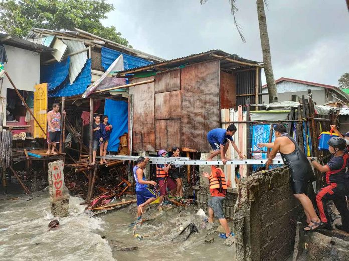
ILOILO City – With heavy monsoon rains made worse by Typhoon “Fabian” pounding several areas of Western Visayas, the Mines and Geosciences Bureau (MGB) alerted areas prone to flooding and rain-induced landslides across Region 6.
It’s best to know the latest advisories from the state weather bureau Philippine Atmospheric, Geophysical and Astronomical Services Administration (Pagasa), according to Mae Magarzo, chief regional geologist of MGB.
Residents in vulnerable areas should watch out for signs of impending landslides like cracks, tilting trees and the presence of water in areas barely visited by flood, Magarzo said.
For flood-prone areas, Magarzo stressed the public must monitor the level of water in rivers and creeks, among others.
“Prepare your survival kits and be ready to evacuate if nasa critical level na ‘yong tubig,” she added.
As of 5 p.m. yesterday, Pagasa said “Fabian” was moving over Miyako Islands while maintaining its strength.
“Fabian” is forecast to be at 595 kilometers north northeast of Itbayat, Batanes at around 2 a.m. today.
Meanwhile, local government units (LGUs) were told to consult their geohazard maps for a more efficient disaster preparedness response planning.
A geohazard map is a specialized map that indicates the hazard susceptibility of areas, particularly to flooding or landslides. It also indicates the percentage of people to be affected should calamity strike those high-risk areas.
Geohazard maps also help LGUs identify passable roads or alternate routes when distributing aid to affected communities.
Magarzo said all 177 towns and 16 cities in Western Visayas were given geohazard maps.
The geohazard maps distributed by the MGB-6 to the LGUs are for the Municipal or City Disaster Risk Reduction and Management Office’s (MDRRMO or CDRRMO) use.
Prior to the distribution, MDRRMO or CDRRMO personnel must undergo a seminar on how to use the geohazard maps. Intensive IEC campaigns were also conducted by the MGB.
Geohazard maps are color-coded, indicating safe zones and flood- or landslide-prone areas.
According to the MGB-6, the areas were high risk to rain-induced landslides:
* Aklan – Libacao, Madalag, Malinao, Ibajay, Tangalan, Nabas, Malay, Buruanga, Balete, and Makato
* Antique – Valderrama, Laua-an, Barbaza, San Remigio, Patnongon, Bugasong, Tibiao, Cualasi, Sebaste, and Pandan
* Capiz – Tapaz, Jamindan, Maayon, President Roxas, Pilar, Dumarao, Ivisan, Roxas City, Dumalag, and Pontevedra
* Guimaras – Jordan, Buenavista, Sibunag, San Lorenzo, and Nueva Valencia
* Iloilo – Leon, Tubungan, Igbaras, Miag-ao, San Joaquin, Maasin, Janiuay, Calinog, Lambunao, and Alimodian
* Negros Occidental – Cadiz City, Talisay City, Silay City, Murcia, Escalante City, Don Salvador Benedicto, Himamaylan City, Binalbagan, La Carlota City, and Kalabankalan City.
Areas susceptible to flooding:
* Aklan – Kalibo, Numancia, New Washington, Malinao, Banga, Lezo, Madalag, Libacao, Altavas, and Balete
*Antique – Barbarza, Sibalom, San Remegio, Valderama, Patnongon, and Culasi
* Capiz – Dao, Mambusao, Sigma, Sapi-an, Panit-an, Cuartero, Dumalag, Pan-ay, Pontevedra, and Roxas City
* Guimaras – Jordan, Sibunag, Nueva Valencia, San Lorenzo and Buenavista.
* Iloilo – Zarraga, Pavia, Dumangas, Leganes, Barotac Nuevo, Pototan, Dingle, San Enrique, Passi City, and Calinog
* Negros Occidental – Bago City, Pulupandan, Valladolid, San Enrique, Pontevedra, Cadiz City, Sagay City, Escalante City, E.B Magalona, and Isabela./PN


