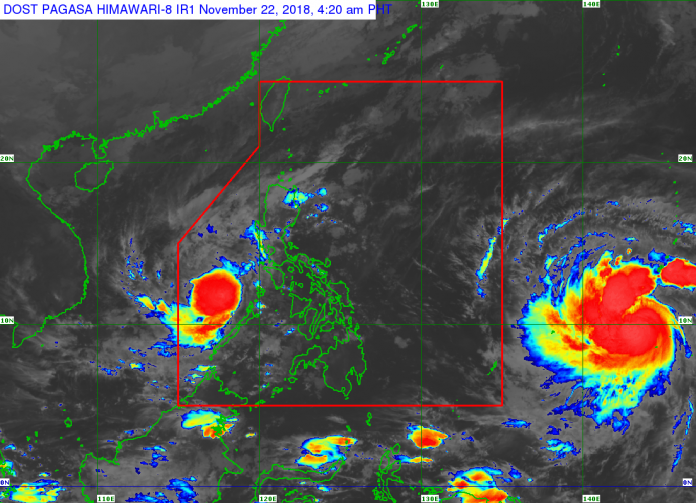
ILOILO City – Some local government units in Negros Occidental and Capiz provinces ordered a preemptive evacuation of their residents on Tuesday night in prepartion for the passing over Western Visayas of tropical depression “Samuel” yesterday morning.
According to the Regional Disaster Risk Reduction and Management Council (RDRRMC), a total of 110 families living in low-lying and landslide-prone areas moved to safer grounds. Late afternoon yesterday they returned safely to their respective homes.
“The evacuation was for the residents’ own safety,” said Ma. Aletha Nogra, assistant regional director of the Office of Civil Defense (OCD) Region 6.
In Negros Occidental, a total of 82 families composed of 232 individuals evacuated; in Capiz, there were 28 families made up of 180 individuals.
The preemptive evacuation in Negros Occidental was Barangay Poblacion in Bago City and Barangay 11 and Barangay Rizal in Silay City. The families sought shelter in barangay gyms, barangay halls and public schools.
In Capiz, evacuation was ordered in Barangay Poblacion, Sapian which was a landslide-prone area. The families moved to the barangay’s evacuation center.
“Samuel” made landfall over Barotac Nuevo, Iloilo around 9 a.m. yesterday.
At 1 p.m. the center of the tropical depression was estimated at 70 km west southwest of Iloilo City or 120 km east southeast of Cuyo, Palawan.
It had maximum sustained winds of 45 kph near the center and gustiness of up to 70 kph.
In the province of Antique, the Provincial Disaster Risk Reduction And Management Office (PDRRMO) prepositioned assests to critical areas to establish close monitoring and coordination.
Likewise, PDRRMO and municipal DRRMOs provided constant advisories to communities, particularly in geohazard prone areas.
In the 8 o’clock weather bulletin of the Philippine Atmospheric, Geophysical and Astronomical Services Administration (Pagasa) last night, Signal No.1 over Iloilo, Capiz, Guimaras and Romblon has been lifted.
“Samuel” had moved south of Cuyo archipelago and was approaching Palawan. It was expected to exit the Philippine Area of Responsibility between Thursday evening and Friday morning, according to Pagasa.
The state weather bureau lifted the storm signal No. 1 in Negros Occidental much earlier, at 5 p.m. yesterday.
“Samuel” was expected to make landfall in Northern Palawan between last night and this morning.
Pagasa still warned of moderate to heavy rains, which may trigger flooding and landslides, over Palawan including Calamian and Cuyo groups of islands, Aurora, Quezon and Mindoro provinces, Panay Island, and Guimaras.
Residents of these areas, especially those living near or in river channels, low-lying and mountainous areas, were advised to take appropriate measures, coordinate with local disaster risk reduction and management offices, and continue monitoring for updates.
“Samuel” is expected to exit the Philippine Area of Responsibility between tonight and Friday morning./PN


