ILOILO City – Local government units (LGUs) should utilize geohazard maps for a more efficient disaster preparedness response planning, according to the Mines and Geosciences Bureau (MGB), an attached agency of the Department of Environment and Natural Resources (DENR).
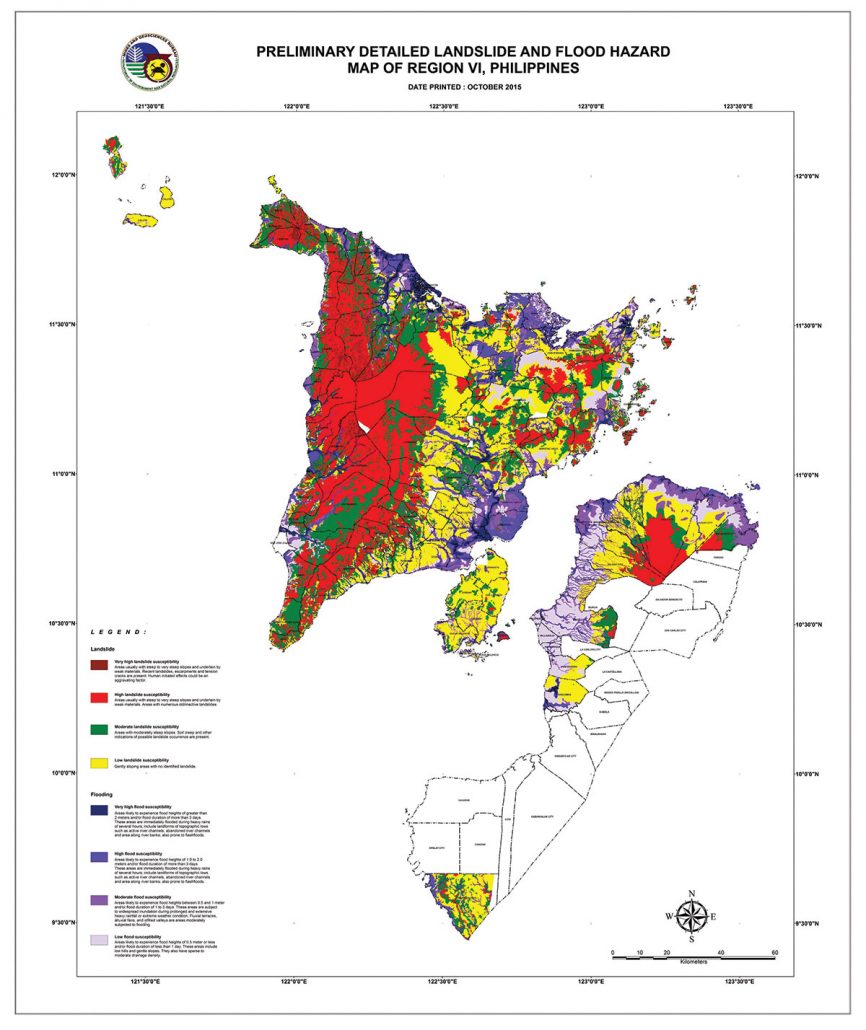
A geohazard map is a specialized map that indicates the hazard susceptibility of areas, particularly to flooding or landslides. It also indicates the percentage of people to be affected should calamity strike those high-risk areas.
“This map gives LGUs the information and helps them plan kon sin-o ang priority for evacuation,” said Mae Magarzo, chief geologist of MGB in Region 6.
Geohazard maps also help LGUs identify passable roads or alternate routes when distributing aid to affected communities.
Magarzo revealed that all 177 towns and 16 cities in Western Visayas were given geohazard maps.
However, she noted, several LGUs have not made use of their maps.
“Ginpamangkot ko diin na ‘to ang ginhatag namon nga mapa… then they turned silent,” Magarzo said.
The geohazard maps distributed by the MGB-6 to the LGUs are for the Municipal or City Disaster Risk Reduction and Management Office’s (MDRRMO or CDRRMO) use.
Prior to the distribution, MDRRMO or CDRRMO personnel must undergo a seminar on how to use the geohazard maps. Intensive IEC campaigns were also conducted by the MGB.
Geohazard maps are color-coded, indicating safe zones and flood- or landslide-prone areas.
The geohazard map is useful not only to locate disaster-prone areas but also to identify relocation sites and provide inputs in the preparation and updating of the local government’s Comprehensive Land Use Plans (CLUPs).
“The geohazard map is our as tool or reference kon diin dapat ibutang ang residential areas or mga commercial areas,” Magarzo said.
MAP UPDATING
Meanwhile, Magarzo pointed out that one of their setbacks now is the updating of the geohazard maps.
The ongoing coronavirus pandemic is derailing their risk assessment of barangays.
“We are continuously updating our geohazard map. We planned to finish the updating sang Iloilo province supposed to be last year, however, considering nga may pandemic kita so instead nga 11 municipalities naghimu na lang five,” said Magarzo.
Risk assessment is also being conducted in the provinces of Aklan, Guimaras, Antique, and Negros Occidental./PN


